


The Broken Sea

California’s largest lake, the Salton Sea, has a deeply troubled and enigmatic history. Located in the arid Imperial Valley, the aptly named and highly saline body of water is shrinking and becoming more and more toxic, leading to disuse, abandonment and environmental damage to wildlife and air quality. To say the future of these troubled waters has become uncertain is an understatement.
By Eric Herman
I remember back in the early 80s driving south on Highway 86, deep in the heart of south California’s low desert, when I came upon a shimmering body of water just to the east. It was the first time I saw the Salton Sea. I had heard of it for years, but had never given it much thought. It was so impressive I turned off the highway for a brief detour exploring the areas along the salty shores.
The first thing that struck me was its size. The biggest lake in surface area in California (Lake Tahoe has greater water volume) it does look like an inland sea, stretching 35 miles in length and 15 miles wide. Back then, the SS was a popular destination for boating, fishing and owning vacation homes. Surrounded by mountains, it was stunningly beautiful, like a grand oasis in the middle of a desolate, treeless landscape.
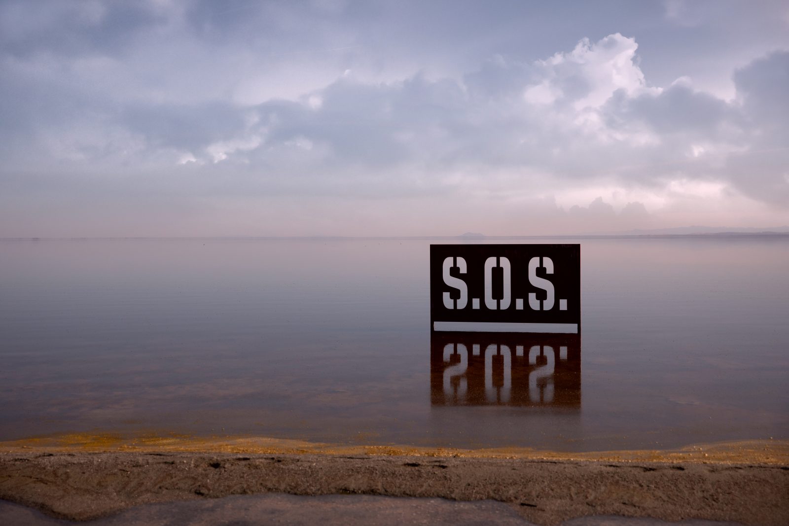
Those were the salad days of the SS. Fast forward nearly 40 years and the scene has deteriorated from idyllic to tragically dysfunctional. Due a variety of factors, chief among them runoff from nearby farmland combined with the fact that its shrinking due to climate change, the SS has become so polluted that no one is allowed to swim in it, you cannot eat the fish, and the exposed shores have become a source of contaminated dust that sullies the otherwise pristine desert air.
Some have deemed the area unlivable as the settlements remaining along the shores, once-vibrant recreational areas and valuable real estate, now look something from a dystopian future. Homes, businesses and marinas are abandoned, leaving small shattered enclaves riddled with crime, drug trafficking and overall human dysfunction. It is a sad and forlorn place, a broken inland sea that is absent of hope or any kind of active public initiative to revive it.
Seeing the SS now begs the question what happened? How did a body of water so full of potential and beauty becomes to troubled?
HISTORIC ACCIDENT
The SS was manmade, but it was unplanned, essentially the result of an engineering miscalculation on a massive scale. Back at the turn of the 20th Century, the state of California was investing in the infrastructure needed to irrigate the Imperial Valley, which despite its arid climate, was and is relatively fertile farmland. The main source of water for the new system of canals was the Colorado River.
The Colorado was still very much the wild river that carved the Grand Canyon and flowed into the Sea of Cortez. The massive dams, including the Hoover Dam, which now control the river and create places like Lake Mead and Lake Powell, were still decades away from being built. In 1905, the river rose due to heavy snowfall in the Sierra Mountains and overflowed the canal banks, which were not engineered with 100-year storm surge in mind. The flood went on for two full years, filling the lowest point in the valley, nearly 300 feet below sea level. In that relatively short time, where there was once desert, the Salton Sea now existed.

The salt content comes from the composition of the ground surrounding the SS and hovers around a highly saline 44 part per thousand, which is less than the Great Salt Lake and the Dead Sea, but more than most parts of earth’s oceans.
For years the lake thrived and in 1930, parts of the SS’s wetlands were established as wildlife reserve. Birds and fish were abundant and the local economy grew as did the area’s reputation as a great vacation spot. For nearly a half century, only a small number of concerned environmentalists predicted the trouble that lie ahead.
There were studies in the 60s and 70s that accurately foretold the looming catastrophe, but virtually no one listened. The cost of mitigation was exorbitant and there was little public appetite for saving a lake that was a giant mistake in the first place.
While the SS was created by human miscalculation, it was destroyed by negligence. The lake has been steadily contaminated by groundwater containing a massive cocktail of chemicals introduced by nearby agriculture. Heavy doses of compounds containing nitrates, phosphates, salt, metals such as selenium, steadily contaminated the water. In recent years, when the water has been churned by storms, botulism that forms in the putrefied lower depths is driven to the surface creating genuinely hazardous health conditions.
DEADLY INDIFFERNCE
Because the SS has no outlet, the concentration of has pollutants increased with little effort to remediate the increasing environmental damage. Toxic algae blooms developed in the warm, shallow waters, laying waste to the wetlands, eventually killing the majority of the fish in a series of massive die offs that gained widespread media attention in the ‘90s, along with tens of thousands of birds, which have habituated to the SS as a migratory stopping point.
In recent years, as the waters have receded due to drought, the toxic water has left contaminated beaches that now contribute dangerous dust to the air.
In 2015, then Governor Jerry Brown, established a state commission to study the problem and make recommendations on ways to save the troubled sea. While there is increased attention and public debate about what do with the SS, so far, no active remediation has taken place.
At present, the area’s large deposits of lithium offer some hope of long-term economic recovery for the region. Whether or not that results in greater attention and resources being given to the once-grand Salton Sea remains entirely uncertain.
For now, this accidental sea remains badly broken.
Opening photo by Katrina Brown | Shutterstock, Mummified fish photo by Raisa Natakova | Shutterstock.