


The Waters of Washington
 Eric Herman
The word “awesome” is badly overused these days, but not so when it comes to describing the waters of Washington State, where living in a state of awe is a common state of mind. My wife, Diane, and I recently concluded four years living in the wilderness there and came away from that experience with deepened appreciations for the many ways the presence of water influences how people live. Not to mention how water shapes everything from politics to geography to the names of the professional sports teams.
The presence of water in the landscape profoundly impacts the lives of the people who live around it, and that’s been true throughout human history. Because we rely on the presence of water for our survival – as well as transportation, recreation, agriculture and manufacturing everything from medicine to steel – how we choose to live with water and how we decide to utilize it to a large extent defines who we are. Water is, after all, arguably our greatest natural resource and the main reason that life as we know it exists in the first place.
We recently moved back to our native Southern California to be closer to our family and now live in Palm Springs, Calif., a place far removed from the verdant climes of the Pacific Northwest. I’m sharing these thoughts and observations now as part love letter to one of the most beautiful places on earth and, more importantly, to record the impact that life in the presence of natural watershapes can have on the health and happiness of Homo sapiens everywhere.
BEYOND THE SHORES
Let’s start with a practical example of water’s transformative power. The residents of Washington enjoy the cheapest electricity in the U.S., averaging just over four cents per Kilowatt-hour, about one fourth of what it is in California. The reason for all that affordable power is simple: hydroelectric plants generate most of Washington’s electricity. Water flowing downhill is the original renewable energy source and remains the most cost effective. It’s why Hoover Dam was built and why Niagara Falls is essential to great cities of the Northeast. Las Vegas and New York City wouldn’t exist as they do without hydroelectric power. Affordable power is only one of the many ways that natural waters define life and the landscape in the PNW.
During most our time there, we made our home deep in the wilds of western Washington, nestled in the foothills of Olympic Mountains, on the Olympic Peninsula, in the shade of the Olympic National Forest, near the entrance to the Olympic National Park, and 50 miles north of the state capital, Olympia. Amazingly, all those mythological prepositions seem to fit. And, yes, the tallest mountain in the Olympics is Mount Olympus. It is a landscape defined by lush forests and soaring mountains, all dominated by natural waters, a place many residents proudly call heaven on earth.
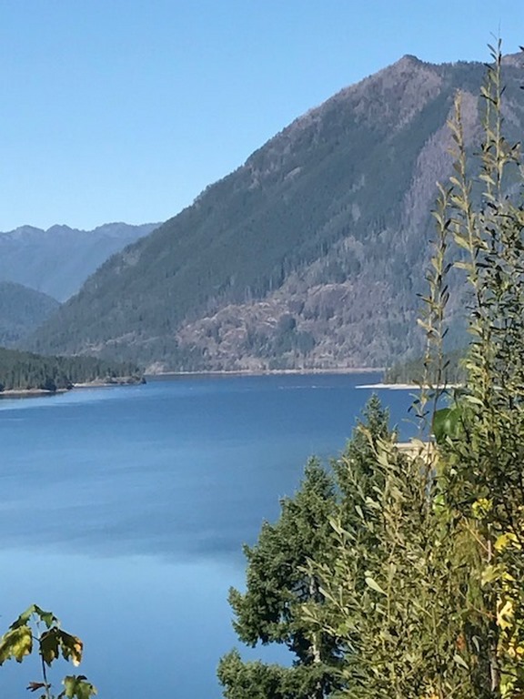
| The mighty Hood Canal is actually misnamed, it’s not a canal at all but instead the largest fjord in the U.S. Looking west across the water, the peaks of the Olympics rise in the distance. |
Not surprising, the waters of Washington were home to Native American peoples for thousands of years prior to the arrival of Europeans. The Quinalt, Nisqually, Wakashan, Tingit, Salish, Skokomish among many other Indian nations lived remarkably abundant lives organized around the ubiquitous waters. A number of those tribal nations are still there and many of the cities, bodies of water, and geological features bear their names.
When George Vancouver’s voyage of discovery arrived in 1792, leading the way for waves of European settlers, he found a region of wondrous diversity where he spent more than two years exploring, mapping and naming places like the straits of Georgia in what is now Canada, and much of the Puget Sound and Hood Canal to the south. Vancouver even renamed the region’s tallest mountain after a British Rear Admiral, Pete Rainier.
And speaking of the truly awesome Mt. Rainier, here’s an interesting factoid: Washington’s tallest peak, visible from most of the state, is covered by more than 30 glaciers, making it one the most dangerous active volcanoes in the world. Reason being, if and when it erupts, all those massive rivers of ice will melt and very likely overwhelm the surrounding cities. Even in the destructive sense, the waters of Washington are extraordinary.
EVER PRESENT
In the company of the countless lakes, rivers, streams, waterfalls, bights, bays, inlets, channels and wetlands, I came to fully understand how water does, quite literally, shape the natural world and the human experience.
I recall one afternoon driving through Shelton, a small logging town located on the Hammersly Inlet off the southern sound. From the road I could see what looked like miles of timber rafts being guided through the narrow inlet toward the Sierra Pacific “sawmill,” one of the most advanced facilities of its kind in the world. Steam from the plant billowed in the clear air over mountains of freshly cut wood that would someday become houses and other buildings in far off places. It was an amazing sight, seeing the way nature and industry work together. Later I was impressed to learn that the Shelton plant produces more lumber than any other facility in the state.
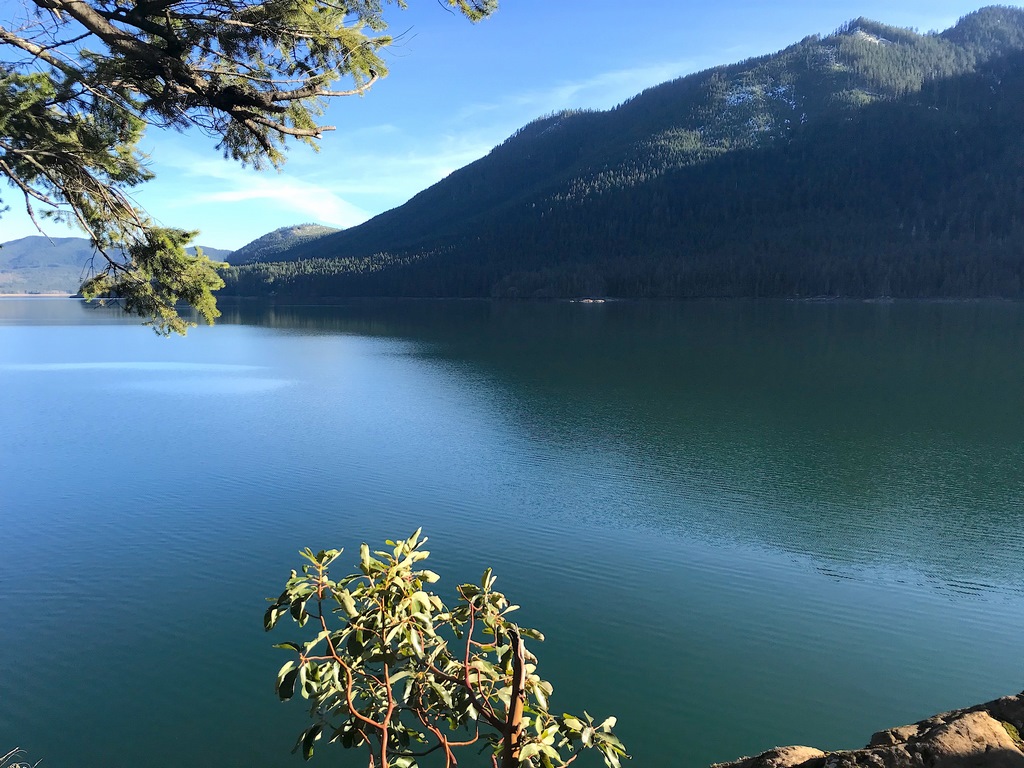
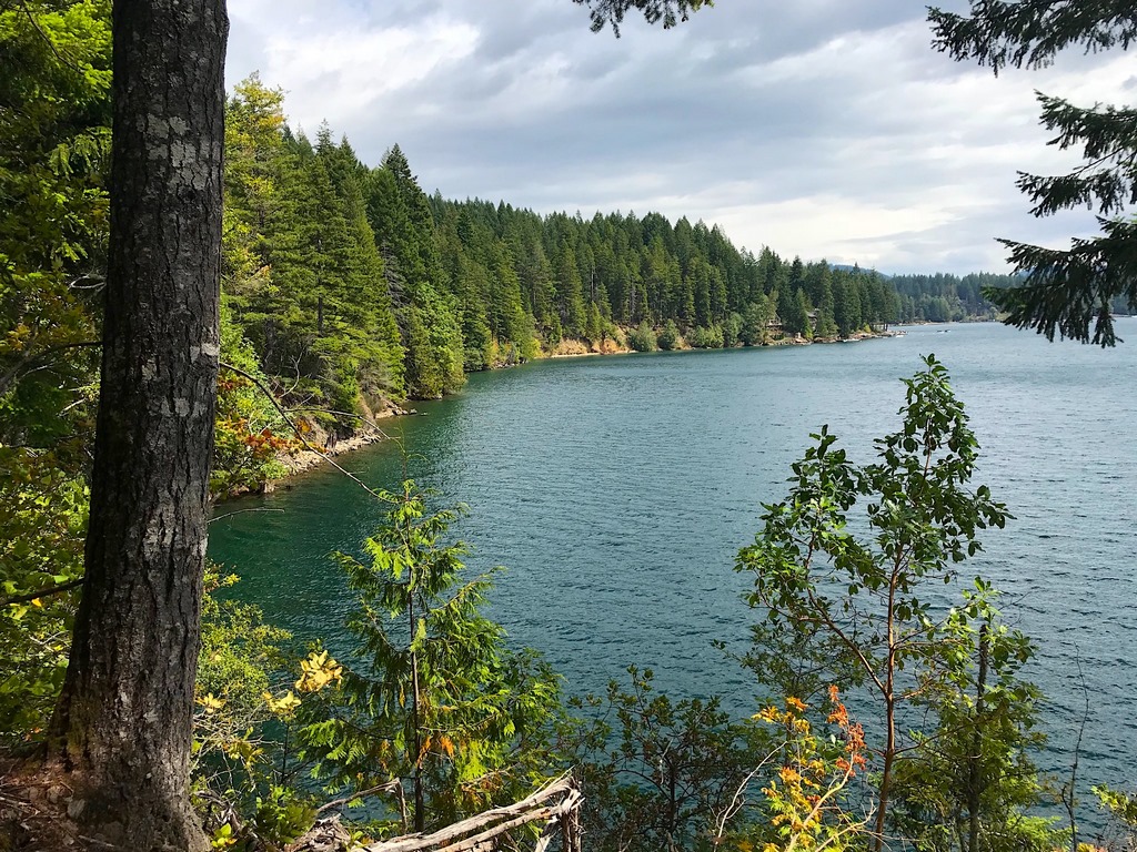
| Countless scenic lakes, including Lake Cushman pictured here, are scattered throughout the landscape providing fishing, boating and countless viewpoints suitable for daydreaming. |
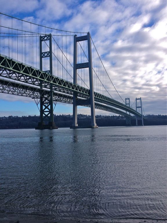
There were countless revelations like that. When we first moved there, we lived in an apartment in Gig Harbor overlooking a stretch of the Puget Sound known as the Tacoma Narrows. As the name suggests, it’s a narrow channel, which separates the East Passage to the north where Seattle is located, from the Southern Basin and its spider web of inlets, islands and bays that lead to the Port of Olympia. I would watch in awe, literally, as the tide moved in and out, accelerating the current and giving the impression of a river that changes direction. It’s an active shipping lane and a popular spot for fishing, but no one swims there because the current is so powerful. (Luckily I didn’t have to find that out the hard way.)
Our place overlooked the Narrows Bridge (pictured above), which quite famously crashed into the narrows due to high winds when it was first being built in 1940. (You’ve probably seen the videos of doomed bridge undulating in the violent wind before plummeting into the water below.) Today, the rebuilt bridge is actually two side-by-side suspension spans that serve as the main traffic artery between the western and central parts of Washington State.
All of that was there to see from our deck.
WATERWAYS OF LIFE
Washingtonians do love their state and they certainly have a lot to say about the precipitation. They take pride in taking it in stride. There’s a saying there that when it rains, people in Washington just put on a hat and walk between the rain drops. While that’s rather romantic, it is true that for a place with so much rain, there’s a surprising dearth of umbrellas. When the sun comes out on a rainy day, they call it a “sunbreak,” which can be a few seconds of sunshine to a few hours.
There’s an appreciation of the natural world that’s missing in some other places I’ve been, and there’s information and tradition surrounding water everywhere you turn. Diane and I were visiting a lovely town on Liberty Bay called Poulsbo, where we visited a small marine biology research and education center. There I was surprised to learn that the Puget Sound is actually the southern section of a massive estuary system known as the Salish Sea. I was blown away, there’s a sea in North America I didn’t know about?
Turns out the Salish Sea is comprised of the Puget Sound, the waters of the San Juan islands, the Strait of Georgia to the north in Canada and the Strait of Juan De Fuca, the massive channel that connects the vast network to the Pacific Ocean. I was relieved when I read that it’s a relatively new name, adopted in 2009 and named for the Native American Tribe that populated much of the northern reaches of the state and southwest Canada.
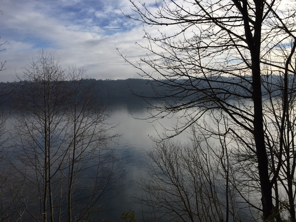
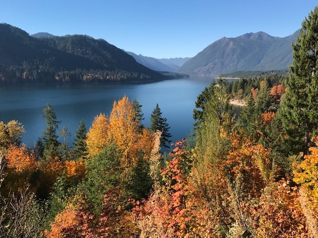
| Morning mist hovers over the Tacoma Narrows, a bottleneck in the Puget Sound, which despite its serene appearance, features a powerful current that changes direction with the tide. |
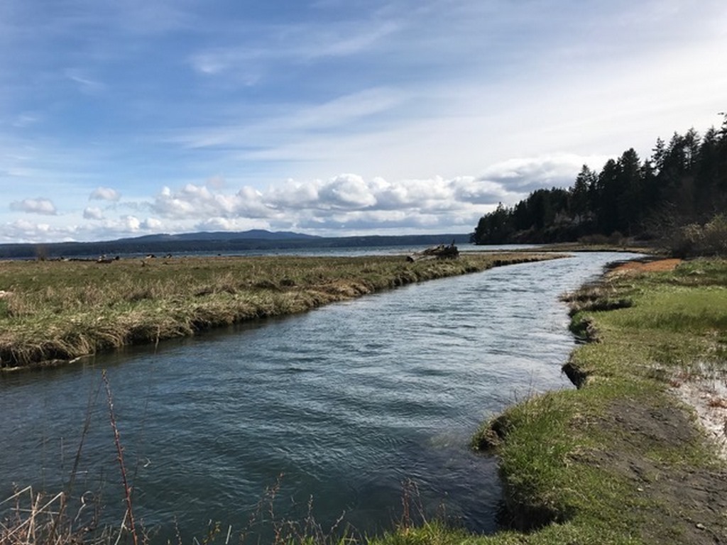
The region’s hydrology and its handiwork are obvious everywhere you look. The rain feeds the rivers that carve the mountains and flow into sea, naturally irrigating vast expanses of lush conifer forests, creating arteries of riparian zones and cascading waterfalls so numerous many don’t even have names. The runoff from the rain wages constant battle with saltwater, filling expansive brackish wetlands that support vast biodiversity and world-class fishing.
In the eastern part of the state, the Columbia and Wenatchee rivers douse a mostly arid landscape with water enough for farming and a bourgeoning wine industry. In the Northwest corner of Washington, the U.S./Canadian border runs though the middle of the turbulent passage into the Salish Sea, where traffic between the two countries takes place by ferry between places like Port Angeles and Victoria.
For someone who’s in the business of considering, exploring and celebrating water, nearly everyday in the “Evergreen State” was filled with discoveries and revelations, all leading back to the its life-giving and land-shaping power. We watched in awe (there’s that word again) as Salmon salmon returned from the sea to fight their way up the cascading rivers to breed and die, and feed legions of hungry bears along the way. Nearby on the winding shores, oysters, crabs, shrimp, and strange bivalve creatures known as geoducks (oddly pronounced “gooey ducks”) thrive in the tidal water of the sound and Hood Canal (the latter of which is actually North America’s largest fjord.)
Almost everywhere you turn, there’s water intertwined with the land. Along the complex shorelines, humans adapt and utilize the water’s presence, with waterside communities from the sprawling metropolis of Seattle to tiny hamlets with names like Lilliwaup, Chehalis, Snohomish, Quilcene, Duckabush, Snug Harbor, Potlatch and Hoodsport. In some of those places, marinas are as commonplace as parking lots.
SEEING TO BELIEVE
In the panoramic view, the waters are indeed genuinely awe-inspiring, but it’s the closer examination that drives my even greater fascination. The second day there while standing on the aforementioned apartment deck in Gig Harbor, I saw an American Bald Eagle pull a baby octopus from the waters of the Tacoma Narrows. It was the first time I had ever seen a bald eagle in the wild; the first of countless times I would see the this majestic bird species hunting over shallow waters and wetlands.
I soon learned that the waters of the sound are home to one of the world’s largest species of cephalopods, the behemoth Pacific octopus, which floats near the surface when it’s young, hence the meal for the eagle. Pods of orcas feed in the complex waters, while egrets, loons and osprey join the eagles in gorging on the natural bounty of fish and other waterborne creatures.
And there are endless bird species everywhere, from Steller’s jays to black-capped towhees, chickadees, robins and about a dozen types of woodpeckers, and even more varieties of waterfowl. And, we fell in love with the flowering plants that need lots of water, like azaleas, hydrangeas and the state flower, rhododendrons. Spring in Washington is like nothing I’ve seen anywhere else. The waters shimmer as the landscape explodes with color.
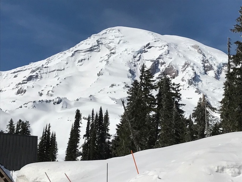
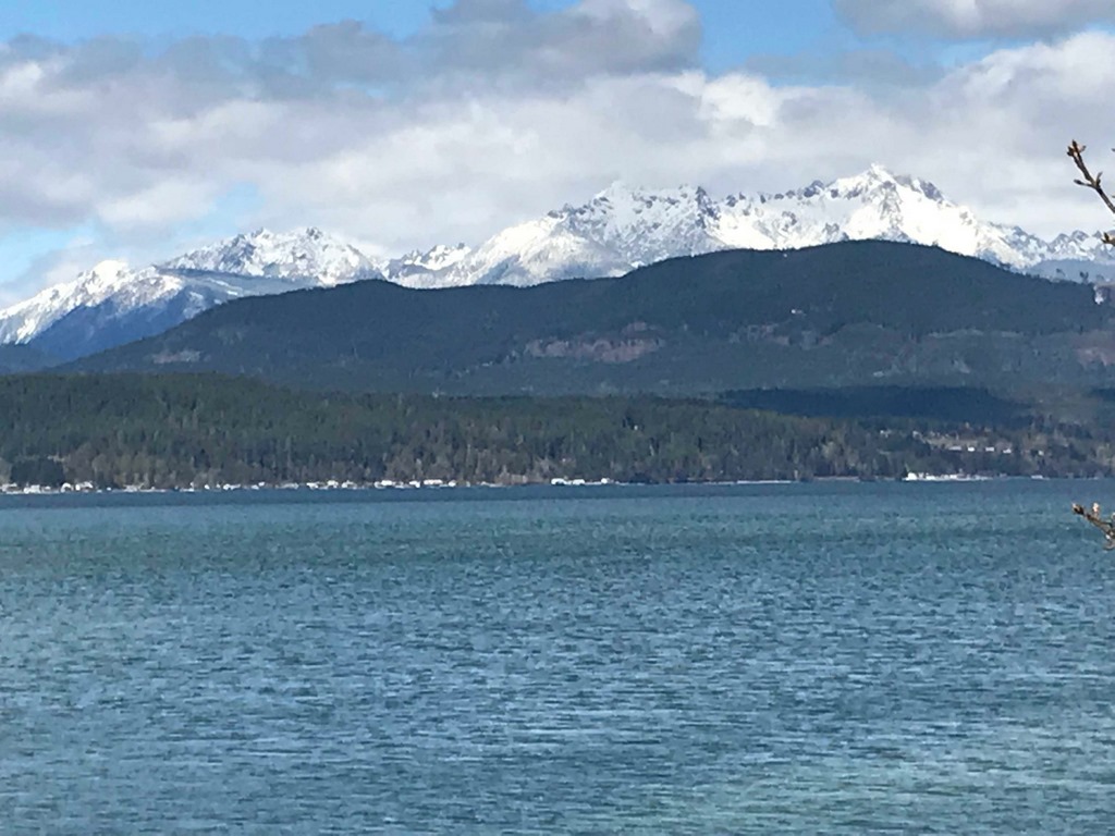
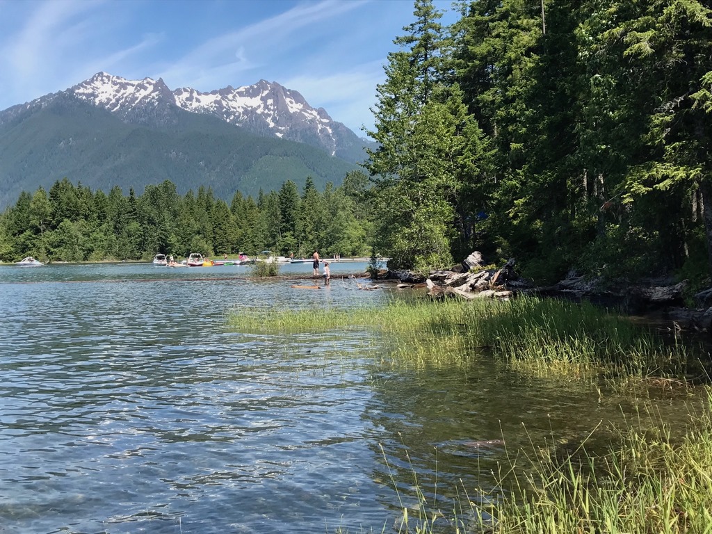
| Visible from a majority of the state, Majestic Mount Rainier is covered year ’round with snow and more than 30 glaciers. Native Americans called it Tahoma and believed the mountain possessed powerful spirits that ruled the land. |
From a watershaping perspective, the waters of Washington are not tamed by humankind; but, instead, they dictate manmade infrastructure and human activity. Rafts of timber are still transported to mills and processing plants, commercial fishing is both ubiquitous and tightly controlled, and everywhere people gather by the water’s edge to fish, scuba dive, hike, dig for clams and daydream.
The presence of water certainly defined our experience in the PNW. After Gig Harbor, we lived in a cozy cabin overlooking a manmade reservoir called Lake Cushman, a 13-mile long and 1-4 mile wide spot in the scenic Skokomish River. The river is fed by snowmelt from the nearby peaks, part of a vast system of watershed rivers and streams. The lake was created during the Great Depression to drive the turbines at the nearby Potlatch hydroelectric plant, which lights the city of Tacoma, some 50 miles to the east.
Lake Cushman is nestled in a natural river valley amongst soaring snowcapped volcanic peaks made of basalt, sculpted by millions of years of erosion. The southeast entrance to the Olympic National Park is five miles up the river and the whole area with its close proximity to the Hood Canal has become a popular destination for all forms of aquatic recreation. The sound of falling water fills the air along with the whispering winds, honking Canada geese, and often the sound of people enjoying the ascendant natural surroundings.
It is also a place with the logging industry is locked in an ongoing blood feud with environmentalists, and native American nations wield tremendous power by way of water, fishing and logging rights. But the human struggles and conflict shrink in comparison to the overwhelming power and immensity of the landscape and the waters. It’s easy to forget that stuff when you watch the sun rise over the landscape that looks like something from a postcard, or a screen saver.
LITTLE BIG ADVENTURES
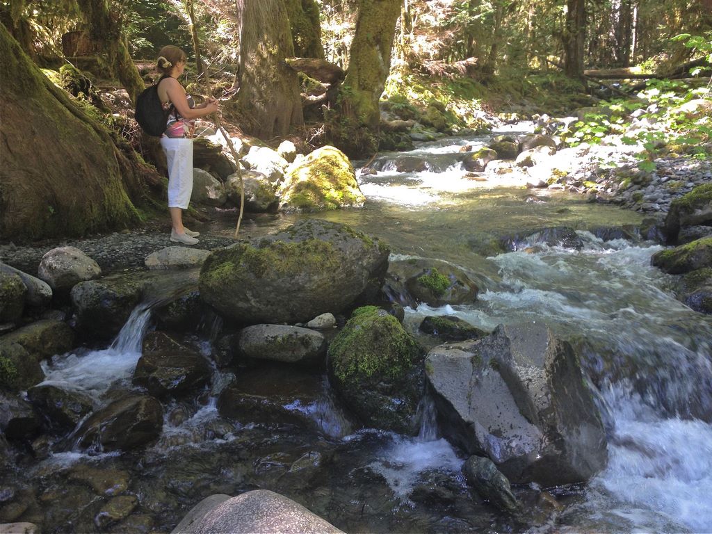
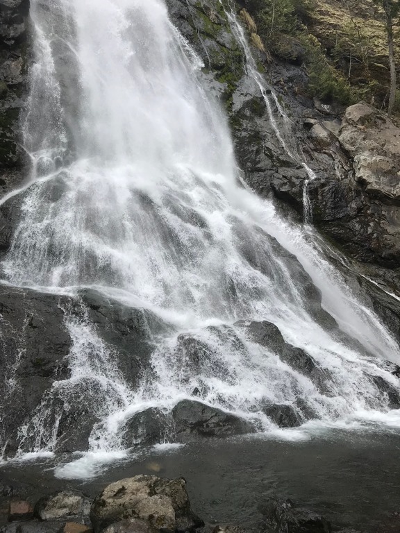
We took numerous day trips filled with all sorts of fun and interesting discoveries. One day while following the Hamma Hamma River, we came up on a trail that led to the Rocky Brook Falls, a place only local residents know about. When we walked the gentle quarter-mile trail, we were confronted by massive 200-foot falls tumbling down an equally massive rock outcropping. The base of the falls is comprised of fallen boulders that formed a natural swimming pool, where families, teenagers and tourists frolicked the hours away.
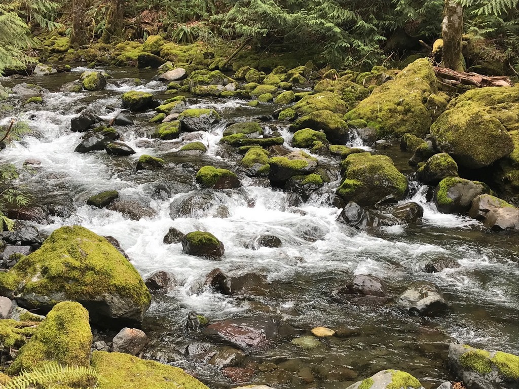
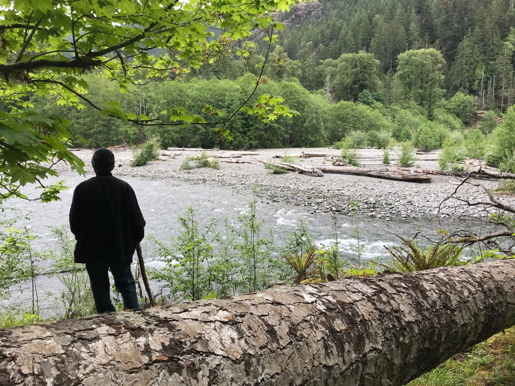
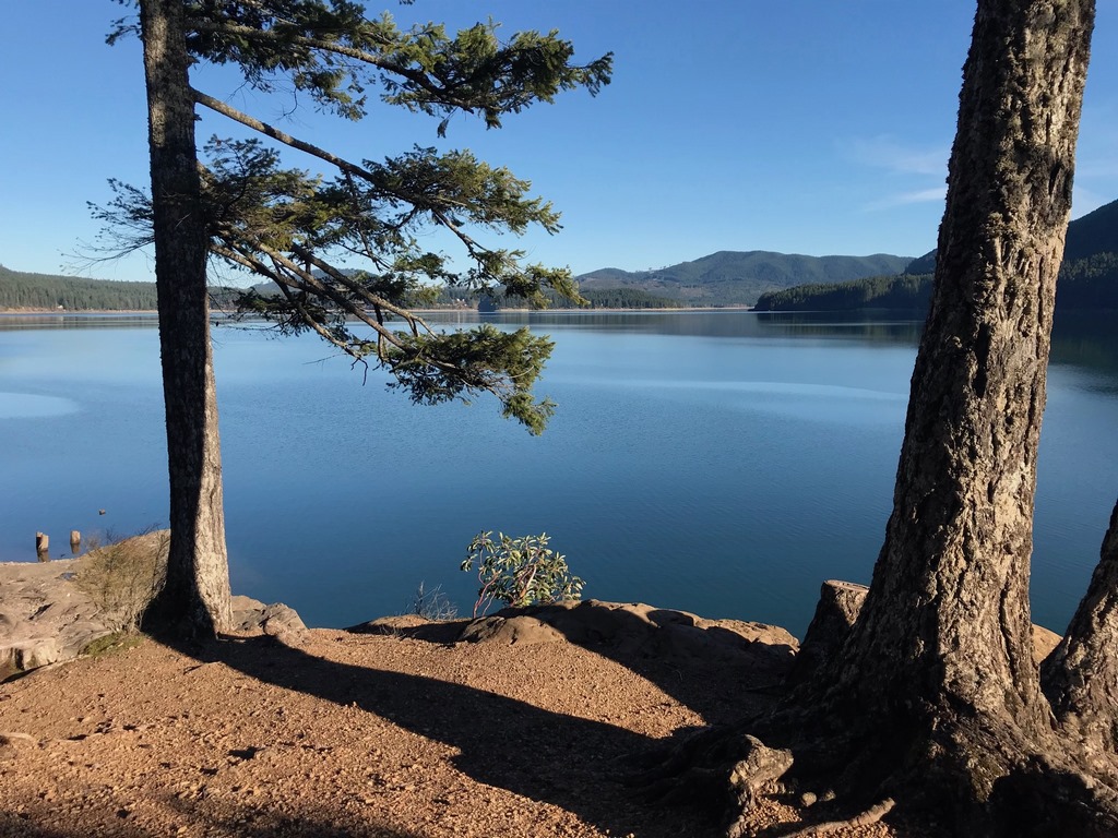
| Throughout the state, streams, rivers and cascades are fed by frigid snowmelt, creating vast riparian areas bursting with life, and more than an occasional human visitor. |
Our outings led us to places like Port Townsend on the northern tip of the Kitsap Peninsula, a city of 15,000 devoted almost entirely to the maritime industries of boat building, marinas, commercial fishing and seaside luxury and indulgence. It was one of many places where you can catch a Ferry and head north across the water to Canada or the San Juan Islands, or Seattle and Everett to the east.
On the Pacific Coast there are miles upon miles of wild beaches, untrammeled by man. As a California native, I didn’t even know that such wild places still existed by the ocean, but there in Washington you can walk along beaches the that stretch as far as the eye can see, the only company being the seabirds, razor clams and other visitors.
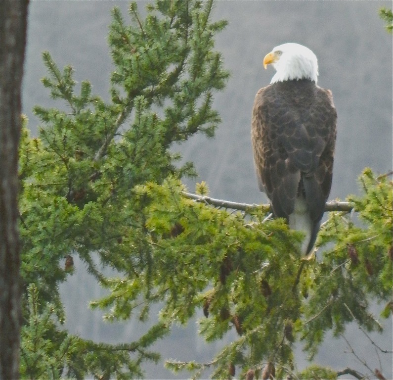
| Once nearly extinct, Bald Eagles are abundant in Washington where they thrive on a smorgasbord of aquatic life – and they even occasionally perch long enough for a photo. |
On the east side of the Puget Sound, the Cascade Mountains and the imposing Mount Rainier rise above land and water like the home of mythological gods. The thundering Snoqualmie Falls draw you to the edge of death and devastation, enveloping visitors in mist, fear and wonder. The emotional impact of these places, and countless others, cannot be measured or adequately expressed, but only felt.
As I write this and look out over a desert landscape — a realm largely defined by the scarcity of water — I know I’ve left something behind that will be with me forever. I’ve been lucky to have lived in Washington for a time and also places experienced the waters of California like the Monterey Bay and the scenic coast of Laguna Beach not too far from here in Palm Spring. These are all places where the presence of natural waters create a lifestyle you can’t find in its absence.
I’m struck by the fact that those who build watershapes are, in effect, leveraging the power of the aquatic experience present in the natural world. It’s also abundantly apparent that to harness that power requires tremendous ingenuity, creativity and ambition.
I’m reminded of the writing of Wallace J. Nichols in his seminal book Blue Mind,and scientifically explaining how everyone is in one way or another influenced, if not captivated, by water. To my blue mind, places like Washington, California, and countless other places are why the word awesome was invented.