


Covering the Traces

Boston’s Big Dig was essentially a Big Fix. Officially known as the Central Artery Tunnel Project, it served to repair damage done to the heart of the city by the Interstate Highway program during the 1950s and ’60s.
In Boston’s case, the federal government had stepped in and inserted a primary traffic artery through what had been a downtrodden area near the waterfront. Its intentions may have been good, but I-93 ran north to south and separated the city’s historic downtown area from its storied waterfront – a disastrous decision that did little more than create decades’ worth of traffic nightmares.
Ultimately, it also required remediation on a scale seldom seen in the course of human history. Planning for the project began in 1982, initiating what would become the largest, most complex and most expensive highway project in the nation’s entire history. It involved burying three-and-a-half miles of new highway beneath the raised highway’s footprint. Once underground, the roadway would join up with the Ted Williams Tunnel and give the city more direct access to Logan Airport before resurfacing beyond the downtown area.
Construction finally began in 1991 and stretched on for 14 more years during which the project displaced tens of thousands of residents and businesses and cost several times the original projected amount. For all of the epic expense and inconvenience, however, the Big Dig’s completion brought an immediate boost to the city, making it whole in ways that, since 2005, have rekindled a sense of community that cannot be measured in dollars.
NEW SPACES
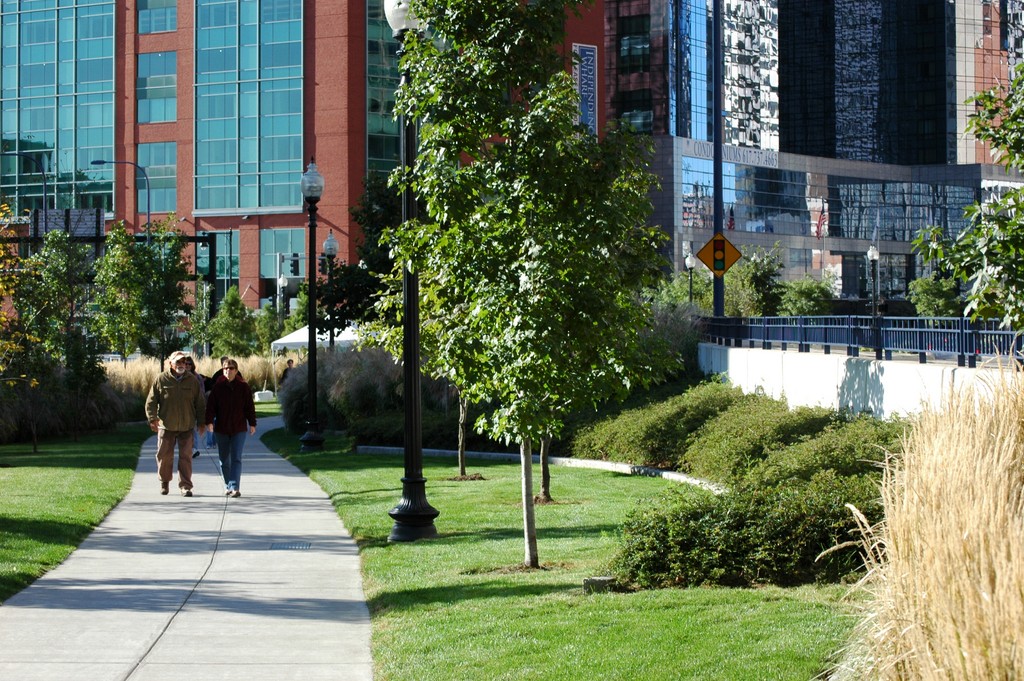
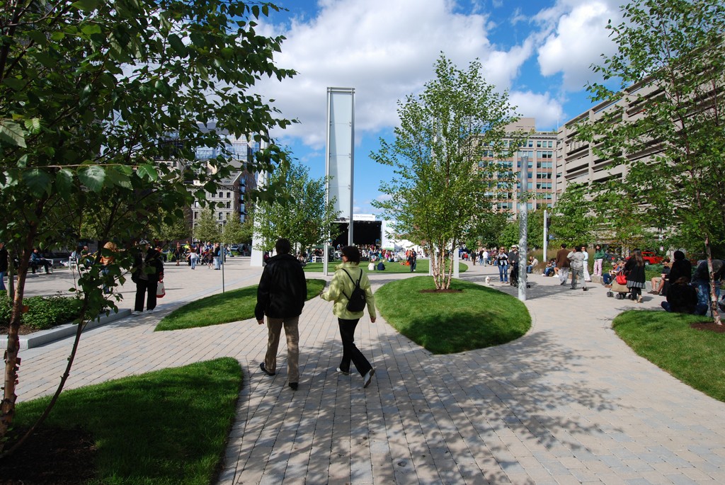
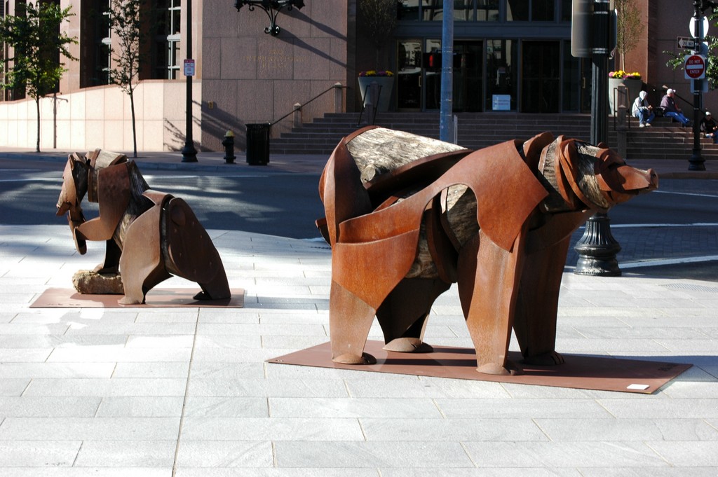
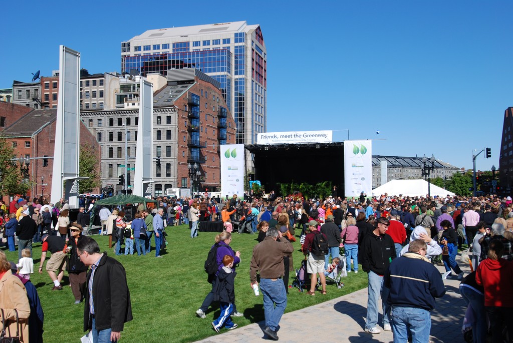
One of the significant outcomes of the project was its creation of new spaces atop the giant roof that covers the tunnel. That area, designated as the Rose Fitzgerald Kennedy Greenway, is essentially a massive green roof and has been dedicated as parkland and public spaces that link the downtown and waterfront areas.
It is with this greenway that our firm, Copley Wolff Design Group of Boston, enters the picture. In the early 1990s, both of us were engaged as citizens in providing our input through various public committees in the planning and pre-construction phases. Before long, the enormity of the project became clear, and the two of us, who until then had each been operating our own landscape architecture companies, joined forces as a single entity dedicated to going after this one huge job.
As designers who wanted to be involved in developing the new space, we felt a profound responsibility to advocate design solutions that were worthy of the historic setting. Our campaign was further based on the idea that it was time for a project that had been driven exclusively by engineers to be turned over to landscape architects. We knew that, eventually, at least part of the new space would take the form of parks, but the first stage of our involvement had to do simply with “surface restoration.”
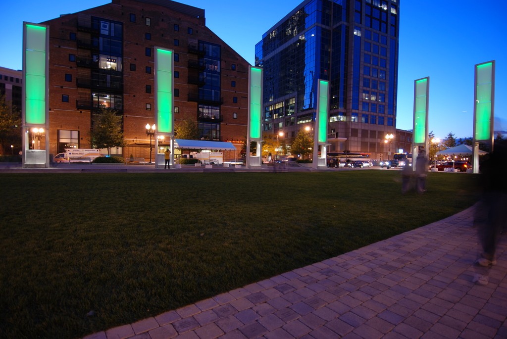
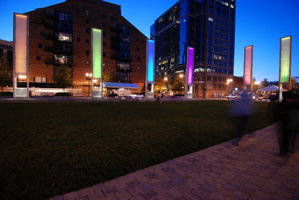
| The parks that emerged atop the massive ‘green roof’ of the Big Dig are all about pedestrian traffic and reforging the links between Boston’s historic downtown and its storied waterfront. Our mission from end to end was to make the most of the reclaimed spaces while allowing them to express the unique character of the neighborhoods they traversed. |
This stage of the process was intensely practical: designing sidewalks, establishing a lighting system, selecting and placing street furnishings and organizing planting plans for all the spaces on the sides of the roadways – the essential framework of the greenway.
Designs for parks were years in the future at that point, but we knew there were to be three of them: North End Park, Wharf District Park and Chinatown Park. Each was to be the subject of a design competition. In making our case, we teamed up with EDAW, the large, international landscape architecture firm, and ultimately secured the contract to tackle Wharf District Park, the largest of the three.
This is, of course, a capsule version of a story that took all sorts of twists and turns in the decade that led to our winning the job. Up to that point, there had been a broad, ongoing, contentious civic discussion about how the space should be used, with some voices advocating residential and commercial development and lots of streets and others, ours included, pushing long and hard for a pedestrian zone and fighting for the concept of open spaces and public amenities.
To make a long story short, these discussions resulted in a compromise in which 75 percent of the area was to be set aside for public parks and 25 percent for commercial development. Further discussions then ensued about what this all meant and in many ways are still ongoing. Overall, we were extremely satisfied with knowing that our city was to gain a “Great Park.” Although the total area amounted to only 13 acres, the planned parks would link key areas of the city in ways that could never be achieved with buildings and streets.
SPACE SENSITIVITY
As we became involved with the project, we recognized that we needed to educate ourselves about the way the tunnel was being built and covered – and even more importantly saw the need to influence how the roof was to be completed in order to make it suitable for the surface treatments and parklands we were considering. In those early stages, in fact, we were chiefly concerned about making the surface ready to support plants.
The project was huge, so it had been divided into sections with separate contractors and engineers taking responsibility for different parts of the entirety of the structure, including sections of the surface. It took some persuading, but we eventually convinced the project managers that there needed to be some consistency among those sections and that the entire surface area should be designed and coordinated by a single landscape architecture firm. Ours was the one selected.
In examining the plans, we saw that, in some places, the roof rose to levels just six inches below grade and that in others it was as far as 70 feet below grade. Keeping the needs of the projected open spaces in mind, we worked with the tunnel builders to coordinate locations of utilities, sub-grade structures and surface hardscape features.
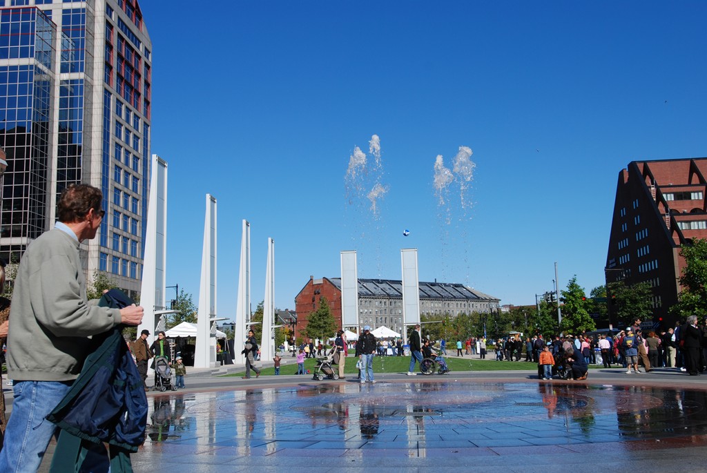
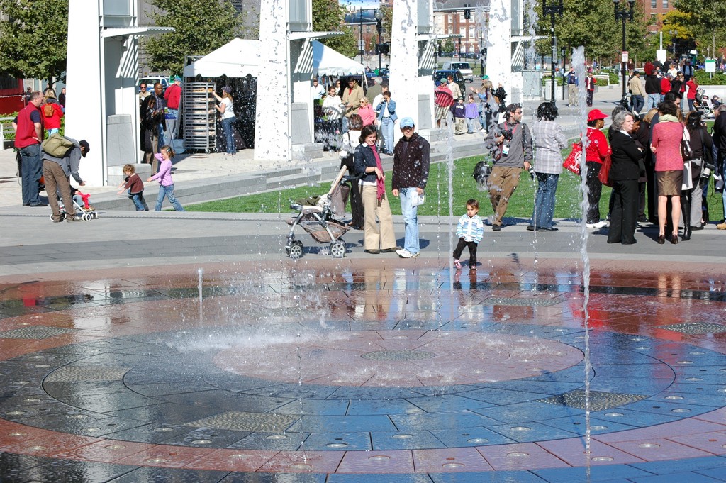
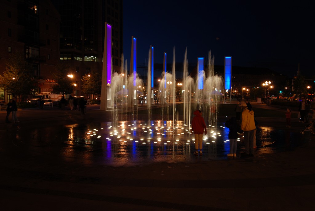
| In addition to working with the overall program for the parks, we also specifically handled the design of Wharf District Park, the largest of the three parks that emerged as parts of the Rose Fitzgerald Kennedy Greenway. The heart of this park is a deck-level fountain that draws visitors together to watch (or play in) a choreographed water display with both day- and nighttime appeal. |
This involvement positioned us as advocates for sidewalks, roadway interfaces and park areas, and the processes were all-consuming as we dealt with thousands of details that in many cases involved just millimeters – amazingly tight tolerances for a project of such gargantuan scale.
For all the drama and the vastness of scope, however, the overall program of surface restoration was relatively simple in concept: The idea was that, running north to south, the area would take the form of a tree-lined boulevard with broad sidewalk areas. East to west, the waterfront and downtown areas were to be connected by a series of cross streets.
The main boulevard moved through several different neighborhoods – the Bulfinch Triangle and North End neighborhoods to the north, the Waterfront, Leather and Financial districts in the middle and Chinatown on the south – each of which had its own history and character. Reflecting those distinctions, the greenway was subdivided to accommodate these neighborhoods, largely through selections of hardscape materials, fencing treatments, plantings and street furnishings that changed slightly from end to end of the space.
The trees we used, for example, changed depending on the neighborhood, with ZelCovas in the Bulfinch Triangle, Maples in the North End, Oaks in the Financial District and Gingkos in Chinatown. All of the cross streets were lined in with Honey Locusts.
Our work in influencing the engineering of the roof included the use of “structural soil” and providing greater quantities of soil in restricted areas. Truth be told, some of our most significant victories in the entire process had to do with securing space between the tunnel’s top and utilities for soil that would adequately support the full range of plantings we had in mind.
WATERS IN THE PARK
The designs for the three parks were completed by different firms, but we all collaborated to the point of including common elements: While each has its own flavor and individual character, there is also a sense of order and continuity.
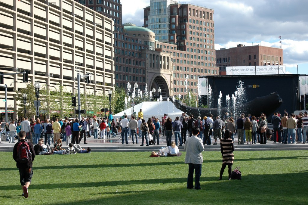
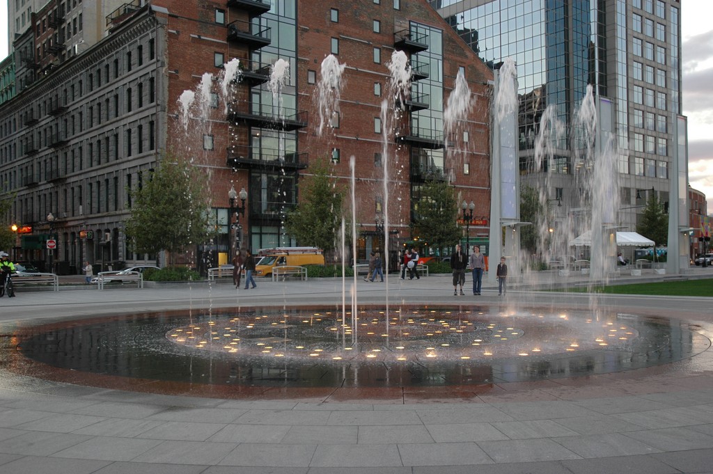
Among the common features were water elements: The North End Park has a deck-level fountain with vertical jets, while Chinatown has a rivulet feature with a small waterfall. For its part, our design for the Wharf District Park includes a pair of significant watershapes, the first a central deck-level, programmable fountain designed by WET Design (Los Angeles), the second a fog fountain created by artist Ross Miller.
The deck-level fountain features a series of leaping jets that function in a number of computer-controlled sequences. The structure’s pavers are held on grade by a system of supports set in a large reservoir. The 100 square feet of deck space is organized in a pair of concentric circles.
Miller’s “Harbor Fog” composition is a motion-activated system lit with LED lights and includes several granite pieces reclaimed from the waterfront’s original seawall. Its maritime theme is perfectly suited to the space and does a wonderful job of linking the park space thematically to the waterfront.
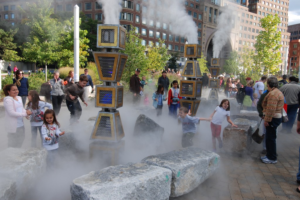
| Another key feature of Wharf District Park is the ‘Fog Harbor’ sculpture devised by Mark Miller. Not only does it use granite pieces harvested from the waterfront’s original seawall, but it’s also a subtly interactive feature that thematically ties its part of the park directly to the harbor beyond. |
As an organization, we never go into a design process assuming that we will necessarily be including water elements, but where they make sense we’re more than eager to go in that direction. In this case, of course, the insertion of water was inevitable for a variety of practical and thematic reasons.
Indeed, water in this context yields multiple benefits: These features serve as destinations and gathering places within the space while also providing opportunities for interactive play as well as relaxation and contemplation. Moreover, it’s just hard to imagine a waterfront park that isn’t somehow tied directly to its backdrop.
The fact that these features “belong” is eloquently indicated by the fact that these areas are among the most popular of all the spaces in the greenway.
The challenge here, as was true with just about every landscape element within the whole scheme, was that we had to interlace these systems with the engineering of the tunnel’s roof. To do so, we basically had to treat the entire Greenway as a gigantic sort of green roof, ensuring adequate drainage and irrigation as well as spaces for root systems and the plumbing, services and utilities needed to make the watershapes work.
In overall sophistication, the real achievement of these systems is not so much in their overall complexity; rather, it has to do with the fact that every millimeter of the design, every nut and bolt, each and every fitting and pipe, had to be carefully planned, communicated and advocated throughout what turned out to be a very long process.
HISTORIC CONNECTIONS
At just under five-and-a-half acres, Wharf District Park is the largest of the three new parks. Given our deep involvement in all aspects of the Greenway, we knew that we needed a partner to assist us with the specifics of its interior design.
As mentioned above, we called on EDAW, which has tremendous capabilities and experience in large civic projects of this sort. Ultimately, they did the lion’s share of the design work for the park, allowing us to continue our efforts as advocates for the overall design. That advocacy was, as mentioned above, all-consuming: During one year of our involvement, for example, we conducted 133 community and committee meetings, each of which required preparation of a separate PowerPoint presentation!
We did manage to keep a hand in the design process, however, generating Wharf District Park’s planting plan and consulting closely with EDAW on every other element. Nonetheless, we know we couldn’t have gotten everything done without their support and give EDAW’s staff tremendous credit for applying their expertise to key parts of the project.
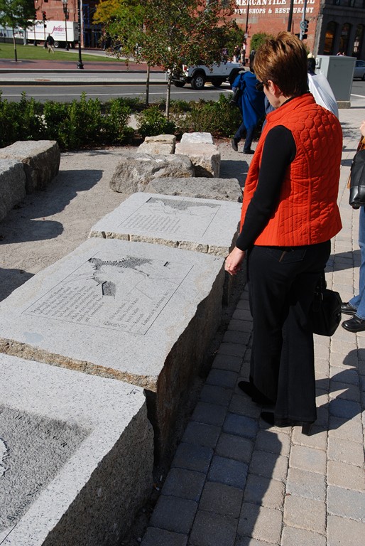
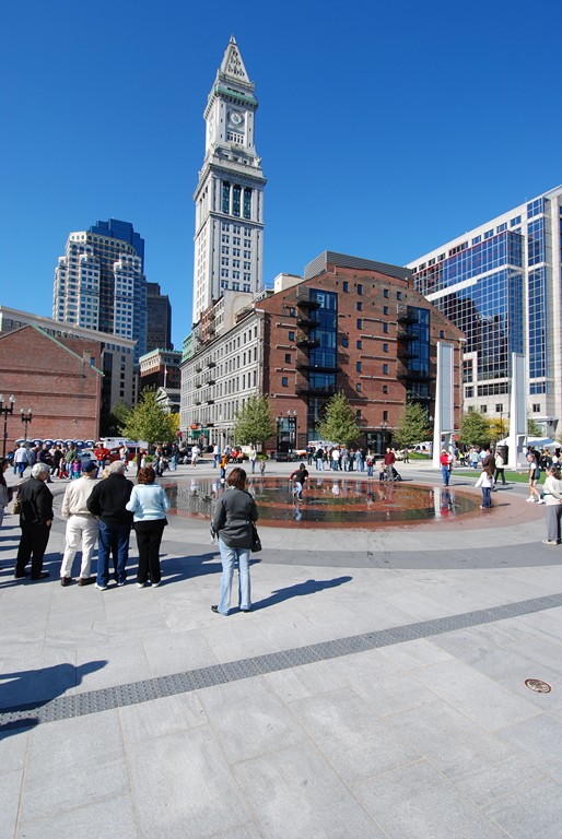
| The park serves the community in a number of ways – as a place to exhibit public art, as the venue for a range of concerts and performances and as a source of information on local history. As important, the fact that the park offers an expanse of open space where there was previously an ugly, elevated roadway now creates visual links from the Greenway to a range of historic features found in the area, including the city’s old Customs House and its splendid tower. |
The reason it’s called the Wharf District Park is because there were originally five commercial wharfs that extended from the approximate location of the park into the harbor. The neighborhoods that now lie between the Greenway and the water came later, as parts of the harbor space were filled and settled in a key phase of Boston’s development. While the original wharfs are long gone, the existing neighborhoods are still defined by that history.
With this in mind, segments of the park and cross streets now correspond to the sequence of the five wharfs, including City Wharf, Long Wharf, Central Wharf, India Wharf and Rowes Wharf, with each one carrying a historic theme. City Wharf, for example, is about land development, while Long Wharf is about the raw materials trade, Central Wharf is about the fishing industry, India Wharf concerns the spice trade and Rowes Wharf is tied to immigration.
The cross streets divide our Wharf District Park into four parcels. The northernmost, which is associated with City Wharf, is on a path called The Walk to the Sea and serves as a pedestrian route for people coming from nearby Faneuil Hall. It has become such a popular thoroughfare that the National Park Service is building a new visitor’s center there.
The Central Wharf area, appropriately enough, includes the Central Fountain and is on an axis with the waterfront’s New England Aquarium – the spot where the water comes closest to the Greenway. Combined with the Long Wharf section just to the north, this space is about festivals and large gatherings, while the southern parcels associated with the India and Rowes wharves are dedicated to smaller-scale performances and events.
These are relatively small spaces, but there’s a lot going on in each.
While the cross-streets form four park parcels and follow the alignment of the historic wharves, for example, they also allowed more permeability and pedestrian and visual access from the built fabric of Boston’s downtown to the open skies and water of the harbor.
This dynamic created another layer of order within the park – on the downtown side in the form of an architectural and formalized promenade along the edge of the park and, on the harbor side, of a naturalistic, curvilinear pathway and plantings. This promenade was a common feature of all contracted segments of the Rose Fitzgerald Kennedy Greenway and allowed for continuity in pedestrian access in the north-to-south direction to counterpoint the cross-streets’ east-to-west orientations.
MOVING ON
For all the progress that’s been made since 1991, the Greenway is still very much a continuing story. As is true with all substantial parks, programming is an ongoing process, and the Rose Fitzgerald Kennedy Greenway Conservancy is currently working to make the most of this wonderful new public amenity.
As was suggested above, the entire Big Dig project has been the subject of vast controversy, both with respect to cost overruns and problems associated with certain aspects of its construction. The Greenway hasn’t managed to avoid some guilt by association and has seen its fair share of criticism from those who initially supported filling the space with blocks of buildings. There are also those who just don’t particularly care for the design.
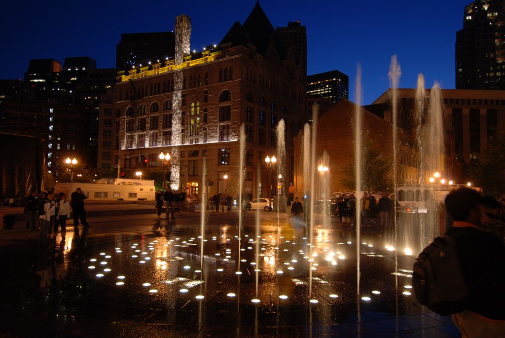
| Drawing people to the Greenway hasn’t been a problem since the parks first opened, and in large measure that’s due to the fact that the designers and artists who lent their talents to the project made it interesting and attractive on so many levels. From the shifting colors of the light panels that surround the fountain to the dancing waters of the fountain itself, there are features that appeal to visitors of all ages. |
We take that in stride as part of what happens with projects of this magnitude, but we’ve also been able to counterbalance the criticism with the sense of satisfaction that has come with seeing the parks in use and perceiving what they already mean to the way the city flows and functions.
Where there was once a hulking, ugly raised highway that cut through the heart of the city, residents and visitors now walk through a series of thoughtfully designed spaces that reflect its history and character as they pass from the downtown district to the waterfront. In a very short time, the Greenway has restored a sense of unity and continuity that had been ripped away more than four decades previously.
All of this is why, as landscape architects who were involved in the project almost from the start and as citizens who will reap benefits of these spaces in the future, we feel only pride and excitement. There are few cities in the Western Hemisphere with as much history as Boston. Through this wonderful project, we’ve been able to participate in restoring a significant part of its narrative, humbled by the experience.
Lynn Wolff, FASLA, is principal and president of Copley Wolff Design Group, Boston. She has more than 25 years’ experience in planning and designing projects for public and private clients and is a registered landscape architect in Massachusetts, New York and Connecticut. Specializing in complex urban projects requiring expertise in project management for multi-disciplinary teams, multiple clients and extensive cultural, historical, public-art and public-participation components, she collaborates with design professionals, artists, government agencies and neighborhood groups to design spaces that reflect the diversity and cultural richness of their surroundings. To those ends, Wolff’s practice has encompassed a broad range of urban parks, streetscapes and community designs in numerous Boston neighborhoods and throughout New England. John Copley, ASLA, is the firm’s founder and owner. He has extensive professional experience in site planning, design and implementation of projects throughout New England and the United States, with responsibilities encompassing all aspects of office management, project management, design and construction observation and community participation. His projects often require sensitive design and detailing that are consistent with historical contexts – but also contemporary in spirit – and he is also actively involved in public planning and design related to affordable housing and town planning. Through the years, he has played key roles in award-winning urban-landscape projects, including the Frog Pond renovation on Boston Common, Dudley Town Common in Roxbury, Mass., and the First Church of Christ, Scientist in Boston.